Announcement!
We’re excited to announce that we’re starting new archaeological works! From 2025, a new phase of the Whithorn and Machars Archaeology Project (MAP) will kick off, and we want you to take part.
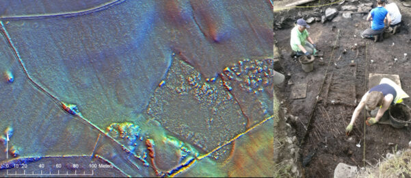
This new stage builds on our citizen science project Machars Waterborne, where we mapped the maritime archaeological landscape of the Machars peninsula, identifying hundreds of potential new archaeological sites through the analysis of airborne laser scan data (LiDAR).
Archaeology Field School
Are you interested in learning more about archaeology? This is your opportunity to get involved! Our investigations will be conducted as a field school, combining training talks, skills workshops and hands-on experience in archaeological techniques.
Our MAP field school will introduce you to the archaeology of SW Scotland and provide professional-led guidance and training in research, survey, and excavation. This will equip you with invaluable skills that are applicable to field archaeology anywhere in the world.
Join us in a new phase of research into the prehistory and history of Whithorn and the Machars, learn the ropes in field archaeology, or develop your existing skills!
Sign up to the mailing list below to register your interest, and keep up to date.
Supported by:


